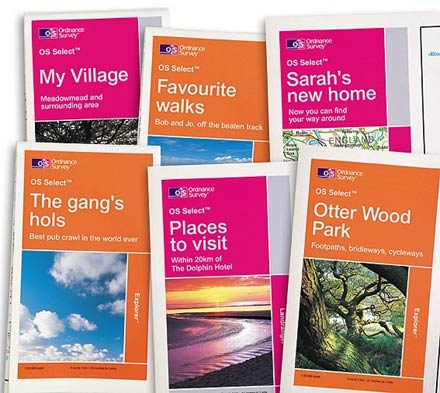
Price: £ 15.99 PLUS £ 2.50 p&p OS SELECT EXPLORER MAP Ordnance Survey has launched an online service where you can order individually printed maps centred on an area of your choice – whether it’s the place where you fish and wish to explore more fully, your favourite waterway or your house. The new OS Select service enables you to site-centre a 1:25 000 scale folded Explorer map on an area of your choice ensuring that everything you need to know is on one map so you never find yourself ‘falling off the edge’! The Explorer map is an ideal companion for anglers that will help you to easily locate car parks, rivers, lakes, ponds and fisheries. If you’re going on a fishing trip you can site-centre your Explorer map on key fishing destinations so you can locate the surrounding villages and amenities. Each site-centred map can be supplied in a water-resistant clear plastic wallet or flat to display on a wall. For that extra personal touch you can even select your own title and front cover. OS Select maps make an ideal treat for yourself or a great gift to guide a fellow angler to some of the best swims you’ve discovered. If you have a friend who has recently moved house, an OS Select would be an essential guide for exploring the waterways in their local area. OS Select maps are also available in Ordnance Survey’s Landranger Map series and maps of both scales can be ordered by logging on to www.ordnancesurvey.co.uk/leisure or by telephoning 0845 200 2712. NOTE | ||||||
|
Welcome!Log into your account


